
Reveal the character of the property
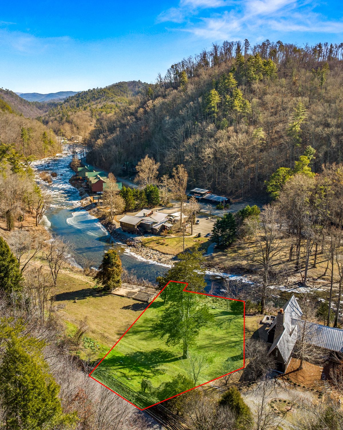
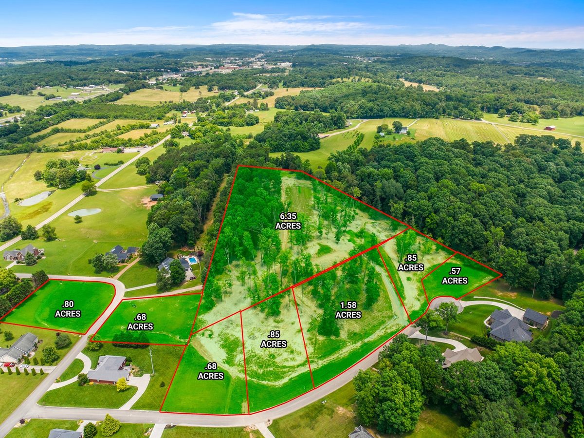
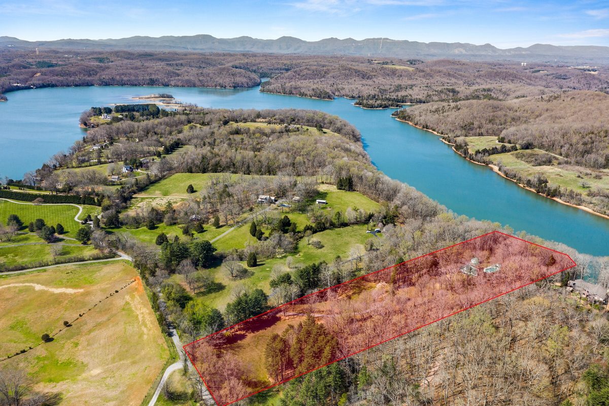
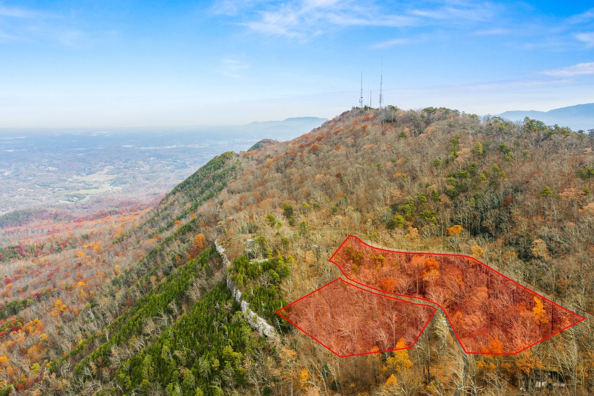
Show terrain, clearings, tree cover, road frontage, nearby development, and other visible features from above.


Land / Lot Aerial Package
Professional aerial photography for vacant lots, acreage, and undeveloped property. Show the terrain, access, surroundings, and setting in a way a map pin alone cannot.
From $149
Serving East Tennessee. Delivered by the next business day.
Vacant land cannot rely on beautiful rooms or architectural details to earn attention. Buyers need help understanding what is there, how the property feels, and how it relates to its surroundings.
Aerial photography turns an unfamiliar parcel into something buyers can begin to picture owning.
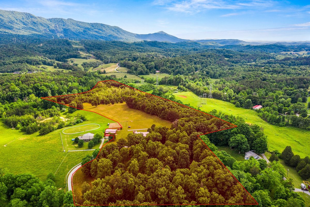
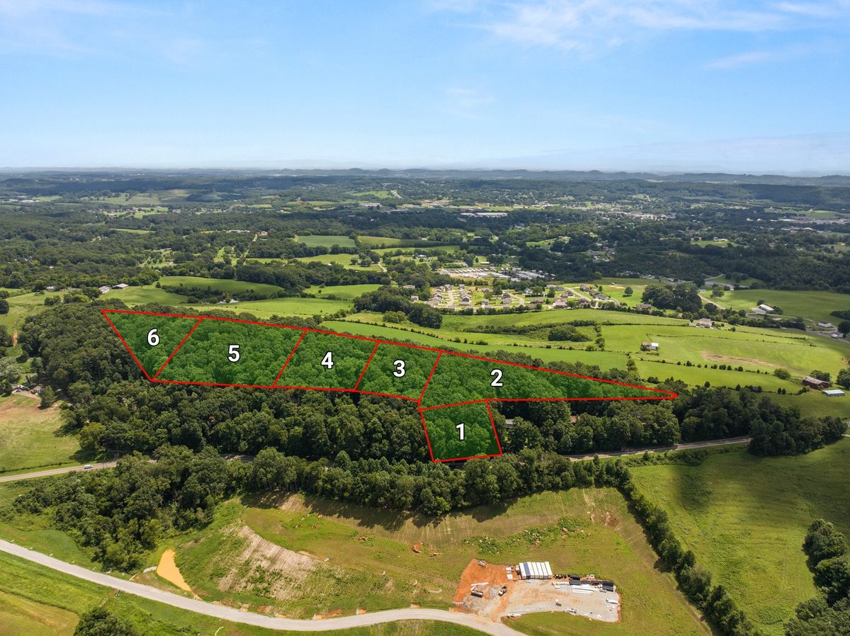
Show terrain, clearings, tree cover, road frontage, nearby development, and other visible features from above.
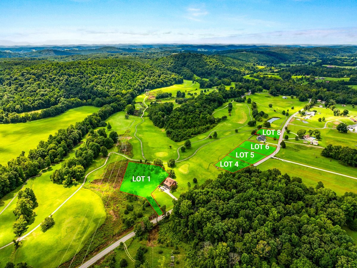
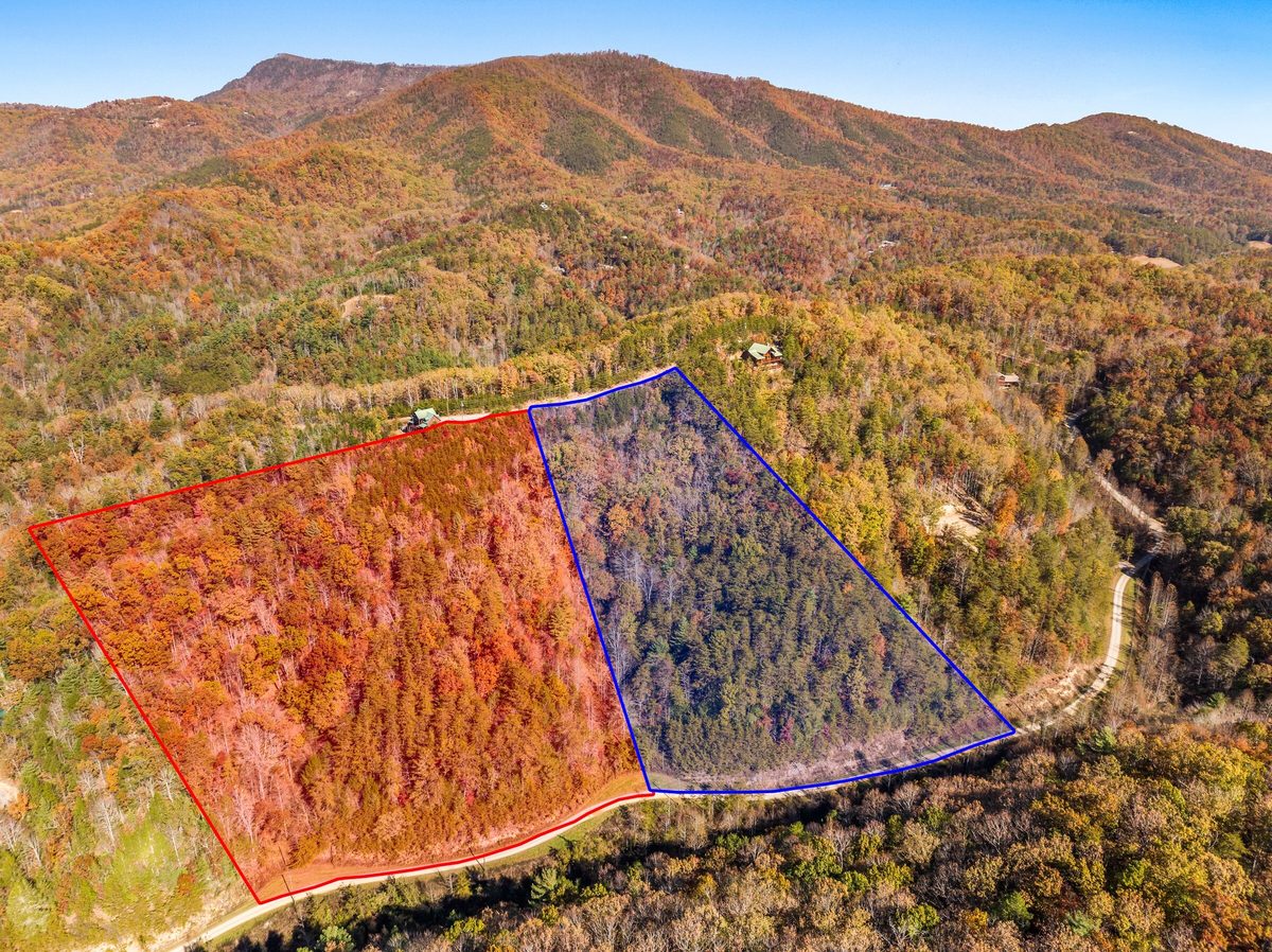
Give buyers a sense of the property's setting, including mountain views, pasture, shoreline, neighboring properties, and surrounding landscape.
Receive one professionally edited aerial gallery ready for MLS, Zillow, your website, social media, and seller updates.
Sellers see their property presented as a serious listing. Buyers gain a clearer sense of the terrain, setting, access, and surroundings before making the trip to see it in person.
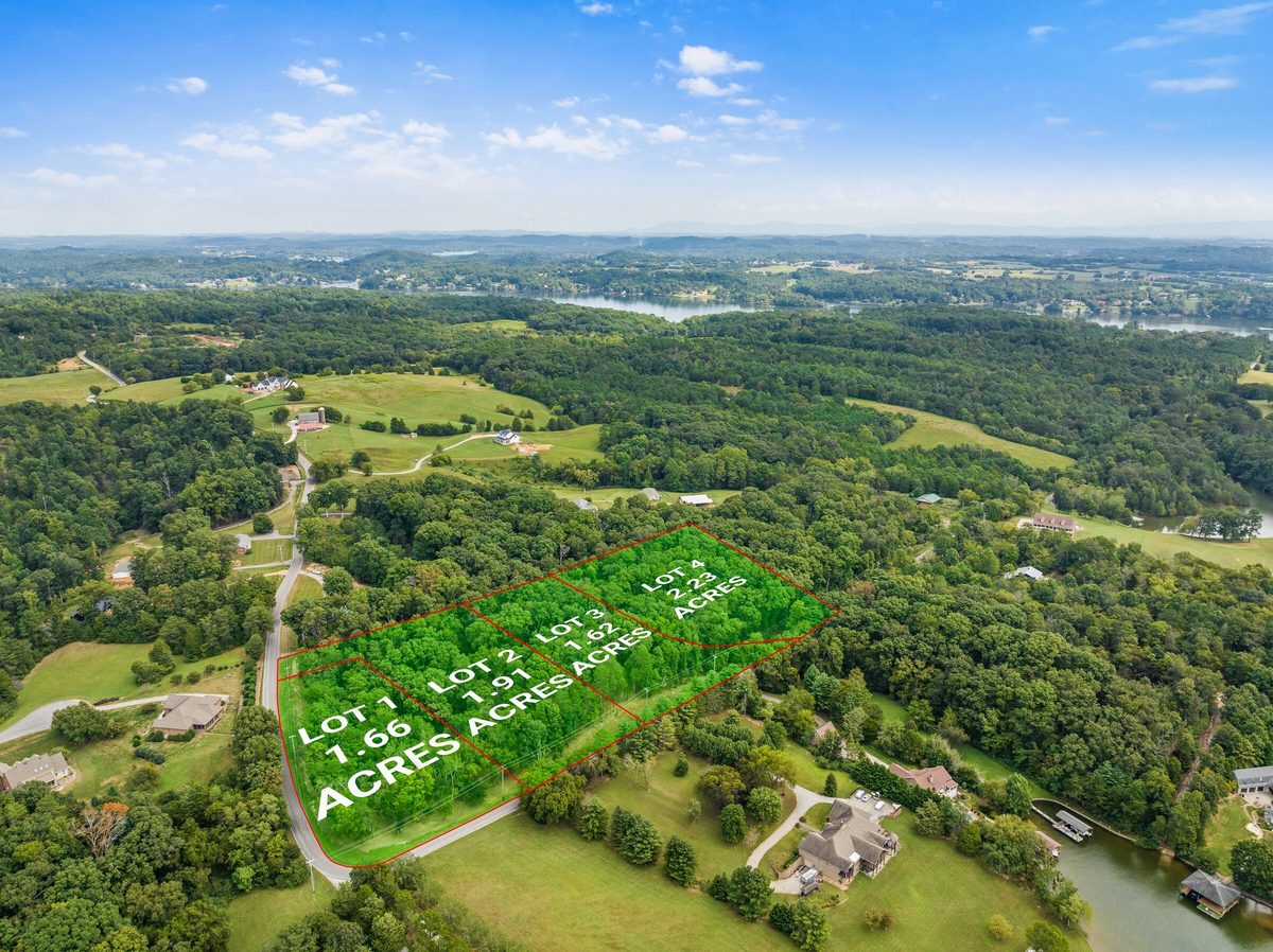
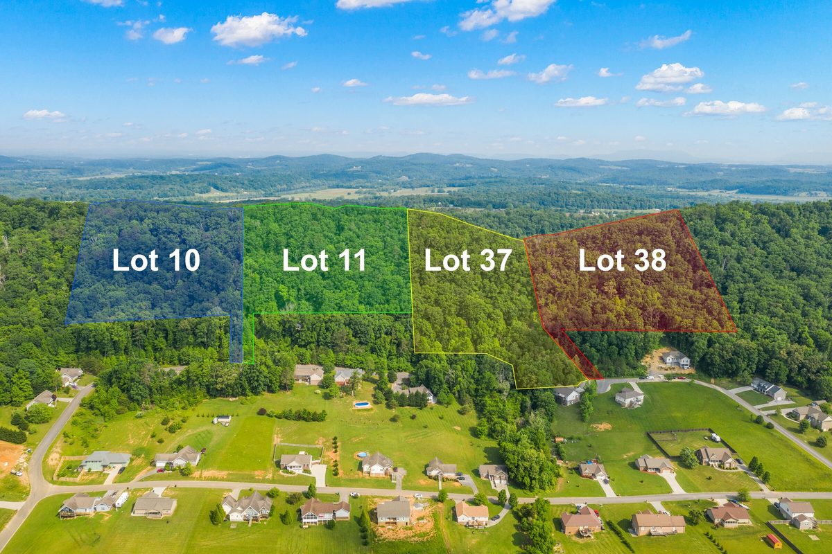
Add approximate boundary lines to selected aerial images:
Boundary overlays are visual marketing aids only. They are approximate, are not surveys, and should not be used to determine legal property lines, acreage, access, or buildable areas. The client must provide a recorded survey, GIS parcel map, or other suitable boundary reference.
Selling a property with a home on it? Explore Photos + Drone
How it works
Pick the coverage that fits the property.
Book online and add the property details.
A trained House Fly photographer handles the shoot.
Media lands on a clear, predictable timeline.